
Measurement systems
LiDAR measurement systems
Wind profiles. Complete field integration.
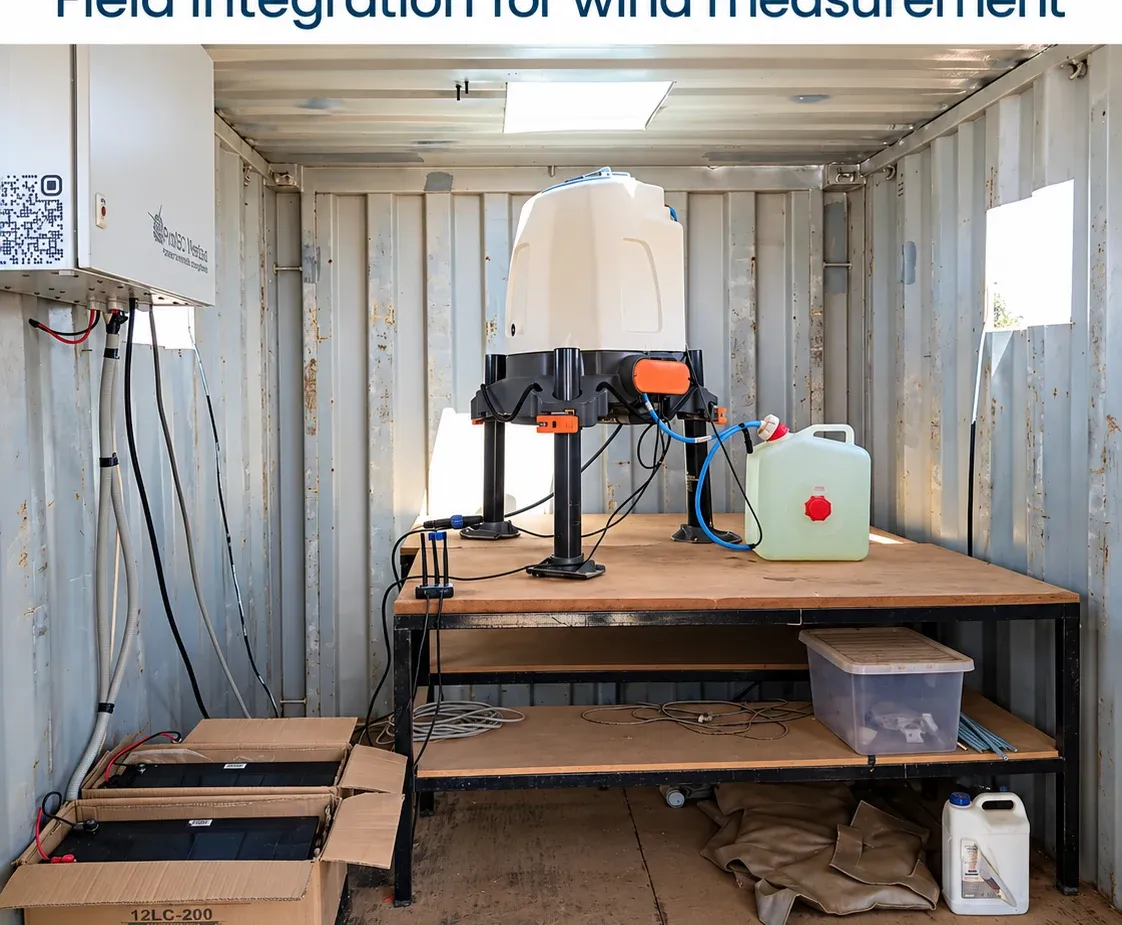
SYSTEM INTEGRATION
Wind profiles. Complete field integration.
Ground-mounted vertical-profiling remote sensing supports standalone and hybrid campaigns. Deployment is planned around the chosen instrument, the site and assessment requirements.
- System supply, lease and deployment options
- Field power and communications
- Pre- and post-deployment verification planning
- Data telemetry, quality review and reporting
CONFIGURATION & QUALITY
Define the system.
Document the approach.
IEC 61400-50-2 informs ground-mounted vertical-profiling remote sensing. Measurement range and verification requirements depend on the selected system and campaign.
The project scope sets out equipment suitability, configuration, checks and the records needed to interpret the observations.
TECHNICAL & PROCUREMENT QUESTIONS
Complete the system scope.
IEC 61400-50-2 informs the applicable scope. Confirm the requirements and relevant edition for your project.
What establishes the technical measurement basis?
Confirm site suitability, instrument performance verification, field power, monitoring and quality review for the agreed remote-sensing campaign.
What should a scoped quotation include?
Specify the equipment schedule, configuration, installation responsibilities, power, communications, field care, technical records and reporting deliverables. Requirements are confirmed for each site.
Does equipment selection alone establish bankability?
No. The complete measurement configuration, calibration and verification evidence, installation, operating history and quality review must be considered against the intended assessment requirements.
BUILD A CLEARER BUSINESS CASE
Know the scope.
Compare the campaign.
Use your assumptions to compare setup, operations and field-service costs. Then align the technical requirements with the project team.
TECHNICAL BASIS
Specify the LiDAR application precisely.
IEC 61400-50-2:2022 covers ground-mounted remote sensing such as vertical-profiling LiDAR and sodar; it excludes scanning and forward-facing LiDAR. Device classification, calibration, campaign performance checks and measurement uncertainty must be considered for the applicable scope. Measurement heights, terrain suitability and availability are device- and site-dependent; a range or brand alone does not establish campaign quality.
Review measurement standards ↗Your next project
What do you need
to measure?
Share your site, project stage and objectives.